Portalegre (Portalegre)
 |
 |
Its name comes from the Latin Portus Alacer (meaning "cheerful port"). The municipal holiday is 23 May. According to the 2001 census the city of Portalegre had 15,768 inhabitants in its two parishes (Sé and São Lourenço). These two parishes, plus the eight rural parishes, had a total of 25,608 inhabitants. The current mayor is Adelaide Teixeira, who was elected as an independent.
According to a frequently mentioned legend, described by Friar Amador Arrais in his 1589 work, Diálogos, Portalegre was founded by Lísias in the 12th century BC, following the disappearance of his daughter Maia. She was walking with Tobias when she is coveted by a vagabond, Dolme, who kidnaps and murders Tobias.
Lísias is desperate for his daughter's disappearance and goes in search of her, eventually finding her dead by a stream that today is named Ribeiro de Baco. Lísias will die of joy when she thinks she has seen her daughter extend her arms to her. The city that was founded in the meantime was given the name of Ammaia. Lysias would also have built a fortress and a temple dedicated to Bacchus on the site where the Church of São Cristóvão stands today. According to Friar Amador Arrais, ruins of this temple still existed in the 16th century.
It is believed the legend resulted from fantasies somehow supported by the existence of a tombstone with a dedication to the Roman emperor Commodus (161-192), which was probably brought from the ruins of the Roman city at São Salvador da Aramenha, near Marvão, which is now commonly accepted as the Roman Ammaia referred to in various historical sources.
The location of this and other cities mentioned in sources from the Roman period, Medóbriga, was the subject of controversy until, at least, the beginning of the 20th century, with speculation until that time whether there were any important ancient settlements in the area currently occupied by the city or in its surroundings.
The name of Portalegre comes from Portus Alacer (meaning "happy" port or crossing point). It is likely that in the 12th century there was a village in the valley to the east of Serra da Penha. The name of Portalegre, where one of the important activities would be to provide shelter and food for travelers (hence the name of port, crossing point or supply). The contrast of its green slopes and valleys with the more arid and monotonous landscape to the south and north may have contributed to its name. The village prospered. In 1129, it was a village in the municipality of Marvão, becoming the seat of the municipality in 1253, having been awarded the first charter in 1259 by Afonso III, who ordered the construction of the first fortifications, which were never completed.
Along with Marvão, Castelo de Vide and Arronches, Portalegre was donated by Afonso III to his second son, Afonso.
The next king ordered the construction of the first walls in 1290, which he himself would surround for 5 months in 1299, following the civil war that opposed him to his brother, who asserted the throne claiming that Denis was an illegitimate child.
That same year, Denis would grant Portalegre the privilege of not being assigned the lordship of the village "neither the infant, nor the rich man, nor the rich lady, but being of the King and of his first heir son".
Map - Portalegre (Portalegre)
Map
Country - Portugal
 |
 |
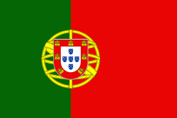
| Flag of Portugal | |
One of the oldest countries in Europe, its territory has been continuously settled, invaded and fought over since prehistoric times. The territory was first inhabited by pre-Roman and Celtic peoples who had contact with Phoenicians, ancient Greeks and Carthaginians. It was later ruled by the Romans, followed by the invasions of Germanic peoples and the Islamic invasion by the Moors, whose rule was eventually expelled during the Reconquista. Founded first as a county of the Kingdom of León in 868, gained its independence as the Kingdom of Portugal with the Treaty of Zamora in 1143.
Currency / Language
| ISO | Currency | Symbol | Significant figures |
|---|---|---|---|
| EUR | Euro | € | 2 |
| ISO | Language |
|---|---|
| PT | Portuguese language |


